Officer
  • Honoring The Fallen
  • Publications
  • Subscribe
  • Advertise
  • Forums
  • Contact Us
  • Vehicles & Fleet
  • Tactical
  • Training & Careers
  • On The Street
  • Investigations
  • Command/HQ
  • Technology
  • Virtual Academy
  • Stations
  • Podcasts
  • Product Guide
  • Topics
    Vehicles & FleetTacticalTraining & CareersOn The StreetInvestigationsCommand/HQTechnologyProduct Guide
    Resources
    ForumsProduct GuideHonoring The FallenBy ContributorsExpert InsightsPublicationsWhitepapersWebinarsOriginal ContentJobs
    User Tools
    SubscribeAdvertiseContact UsPrivacy PolicyTerms & Conditions
    https://www.facebook.com/officercom
    https://www.linkedin.com/company/officer-com
    https://twitter.com/officercom
  • Home >
  • Investigations
  • Mapping & Tracking

    The Officer.com Mapping Tracking product category is a collection of information, product listings and resources for researching various law enforcement Mapping Tracking options.

    Featured Companies

    Gradd Logo 032720
    UAV / UAS

    Global Robot and Drone Deployment (GRADD)

    Jan. 12, 2020
    Steveheap | Dreamstime.com
    Apple Air Tag (dt)
    Mapping & Tracking

    Apple AirTag Found Hidden under Hood of Marked NYPD Vehicle

    Jan. 24, 2023
    The NYPD's chief of housing reminded members to be vigilant when inspecting marked cars after a coin-sized tracking device was discovered in a van in Queens.
    Getty Images 471259221
    Speed Detection

    How to Map Out Traffic Enforcement

    Lt. Frank Borelli (ret), Editorial Director
    Oct. 15, 2020
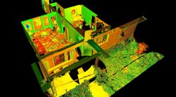
    Agent Clint Norris, New Mexico State Police Crime Scene Team
    3D imaging allows investigators to go back to the scene at any time.
    Forensics

    Bring Your Crime Scene to Life

    Agent Clint Norris, New Mexico State Police
    April 16, 2020
    Vigilant Solutions, a part of Motorola Solutions Inc.
    Lt. Commander of Detectives Tom Joyce (ret), Vice President of Business Development for Vigilant Solutions
    Ballistic Identification

    The Case for Mapping and Visualization in Crime Gun Investigations

    Lt. Commander of Detectives Tom Joyce (ret), VP of Business Development for Vigilant Solutions
    March 19, 2020
    E911 Location Technology

    National Emergency Address Database Abandoned

    APCO International Annual Conference & Expo 2023
    Feb. 18, 2020
    PAR Government
    Par Logo
    Mapping & Tracking

    At ESRI Federal GIS Conference: See New Situational Awareness Tools at PAR Government

    PAR Government
    Feb. 6, 2020

    Latest

    LexisNexis Coplogic Solutions
    Getty Images 57648409 5db31acea23c9[1]
    Reporting Software

    Why Accident Reporting Doesn’t Have to be Such a Dangerous Roadside Task

    LexisNexis® Coplogic™ Solutions
    Nov. 8, 2019
    Geo Slam Church Scan
    Mapping & Tracking

    Mobile Laser Scan Data Improves Police Engagement Time in Active Shooter Simulation

    Aug. 14, 2019
    Mapping & Tracking

    At APCO 2019: GeoComm Featuring New 2D Indoor Mapping

    GeoComm Inc.
    Aug. 1, 2019
    Half The Tool
    Technology

    Is Your Agency Settling for Half the Tool?

    Motorola Solutions Inc.
    July 16, 2019
    Mapping & Tracking

    At IWCE: 3D Location Platform Launched, Aims to Improve Indoor Situational Awareness

    Polaris Wireless
    March 5, 2019

    Categories

    Apparel
    Body Armor Protection
    Body Cameras
    Communications
    Computers & Software
    Corrections
    Distributors
    EMS / HAZMAT
    Firearms
    Firearm Accessories
    Flashlights
    Forensics
    Investigations
    Bug Detectors & Scramblers
    Composite Sketching
    Crime Scene Cleanup
    Crime Scene Tape
    Drug / Alcohol Enforcement
    Expert Testimony
    Forensics
    Gunshot Location Systems
    Mapping & Tracking
    Photography & Equipment
    Polygraph
    Portable Lighting
    Research
    Sound Level Meters
    Video Cameras
    K-9 Equipment & Services
    Less-Lethal
    Security & Surveillance
    Supplies & Services
    SWAT
    Traffic
    Training & Careers
    Vehicles & Fleet
    Comba Telecom Inc.
    Comba Telecom Criticalpoint Antenna Monitoring System
    Wireless Communications Equipment

    Comba's Innovative RFID Antenna Tracks Tags ... Even if They Fail

    Comba Telecom Inc.
    March 4, 2019
    New RFID solution provides the ability to fully monitor a public-safety communications system in real-time
    FoxFury Lighting Solutions
    700300 Rugo Drone Sunset Print
    Investigations

    How To Map a Crime Scene With a Drone

    FoxFury Lighting Solutions
    Feb. 19, 2019
    FoxFury Lighting Solutions and Sundance Media Group host an exercise demonstrating the use of UAV mapping technology in crime scene investigations
    Mapping & Tracking

    Data and Image Analytics Company, VaaS International Holdings, Acquired by Motorola Solutions

    Motorola Solutions Inc.
    Jan. 7, 2019
    Acquisition complements Motorola Solutions’ command center software suite
    GeoComm Inc.
    Pictometry Dispatch Map
    Dispatch Technology

    New Emergency Mapping Software Enhances 911 Call Taking and Dispatch Capabilities

    GeoComm Inc.
    Oct. 25, 2018
    St. Cloud, MN: GeoComm is pleased to announce the general availability for the newest emergency dispatch mapping software, GeoComm Dispatch Map. This software is an exciting, ...
    DT Research
    Dt301 X Tr 1
    Tablets & Handhelds

    A New Rugged Tablet Meant for High Accuracy Measurements

    DT Research
    Oct. 17, 2018
    RealSense 3D Camera is Fully Integrated to Capture Real Time Detailed Images
    Officer
    https://www.facebook.com/officercom
    https://www.linkedin.com/company/officer-com
    https://twitter.com/officercom
    • Contact Us
    • Advertise
    • Do Not Sell or Share
    • Privacy Policy
    • Terms & Conditions
    © 2023 Endeavor Business Media, LLC. All rights reserved.
    Endeavor Business Media Logo