The Evolution of Crime Scene Sketching
In the past, crime scene documentation included photos, (maybe videos taken with a camcorder), and manual diagram sketching. Though these tools were helpful in the past, presently there are much more advanced tools that can be used to document each detail of your scene.
If you have ever had the opportunity to reopen a cold case, often you will immediately notice the difference in quality, (and quantity), of the photos in the case file as well as any video that was captured with a camcorder. Even if in your career you used those types of tools, looking at those case files compared to the current ones is a huge difference.
Sketches were originally done with graph paper. From there they progressed into basic software programs that would generate sketches based on dimensions and measurements entered by the investigator to make them closer to scale. More recent software programs enhance a scene by bringing it to life in 3D. This method is still used today of course for smaller scenes.
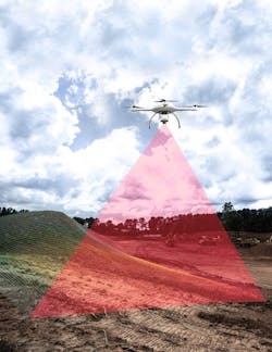
When it comes to larger scenes or outdoor in particular it can be difficult to capture every detail. Drones have made the unthinkable possible when it comes to crime scene documentation on a large scale.
Drones
Drones have given a whole new outlook on diagramming and documenting outdoor crime scenes. One problem that crime scene investigators and detectives often run into is the inability to capture the whole scene. So often a scene will be in an obscure location making it difficult for investigators to photograph the scene. Having a drone allows investigators to document every inch quickly and accurately.
The mdMapper1000DG aaS from Microdrones brings the task of mapping a scene out to a whole new level. It offers a fast and safe way to get the job done accurately in a 2 or 3D form and is rain and heat resistant.
The mdLiDAR1000 aaS produces 3D point clouds which are excellent for a variety of fields including mapping and documenting crime scenes. This particular drone is extremely accurate with an accuracy of 0.2 feet when it is flown at 130 feet at the speed of a little over 6 miles per hour. Instead of having a drone and then a LIDAR system.
The mdLiDAR1000 already has software built into it that way data collected can easily be integrated.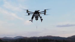
Drone Accessories and Necessities
In order to properly use drones, you must have a radar too. Echodyne specializes in radar equipment for drones. Their focus is on radars for UAS and other like products. Radar works as a sensor with drones to navigate environments. Echodyne's high-performance electronically scanned MESA unit is a new line of high-performance ESA radar for drones. This helps with both security and accuracy.
EchoGuard is the ideal radar for counter-UAS site protection. With a large vertical field of view and fast update rates thanks to true 3D electronic beam steering, EchoGuard accurately detects, tracks, and classifies small UAS where it matters most - within 1 km of your protected site. It provides precise and reliable target location for putting eyes on target, cueing optical sensors, and directing mitigation responses.
With proven performance in live operations and in countless defense, federal, and private tests across diverse environments (urban, suburban, rural, maritime, and even airborne), EchoGuard has earned its place as the preferred C-UAS radar for dozens of counter-UAS system suppliers. Echodyne offers the counter-drone radar of choice for defense and homeland applications.
Zenith Aeroteh (ZAT) products are designed and built in the United States that designs and builds tethered drones—also called tethered aerial systems (TAS)—for public safety, defense, and industrial applications. They use high quality components such as such as radars, EO/IR cameras, wide-area aerial lighting systems, and mobile ad hoc networking (MANET) radios to name a few.
ZAT’s tethered aerial systems can operate for hours or even days making investigation or any other use efficient and long lasting while providing persistent ISR, and force protection. "The TAS products are designed to work in remote locations with a ground power unit that has a backup battery if an emergency should take place", Don Leckrone, Director of Zenith AEROTECH. "Select models can fly while tethered at an altitude of 400 to 800 feet, providing point-of-need capabilities helping in all types of use." ZAT’s tethered aerial systems have incorporated the Echodyne Flight radar, for ground-based ISR activity and counter-UAS applications as well.
"What makes ZAT special is that its engineers have a profound and far-ranging understanding of TAS development and operations, including heavy-lift system design and ground power/tether management," says Leckrone. "In addition, the company takes a highly customizable approach to its product line, tailoring TAS platforms and payloads to specific missions."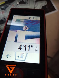
3D Mapping
3D scanning for crime scene mapping is an excellent tool to use whether it includes a drone or not. Faro has excellent options for crime scene mapping too. The technology used both on the ground and in the air is amazingly accurate. With some software systems you and combine the footage you acquire from a scanner you may already have.
Scanners such as Faro’s Focus Laser Scanner offer investigators the chance to make their crime scene a 3D reality. The Focus Laser Scanner has an 8-mega pixel, HDR camera and is light in weight making it easy and convenient to use on scenes. The ScanPlan which is 2D from FARO would also work well for documenting crime scenes. Though great for floor designs it is another great way to capture the layout of a crime scene location. Simply record the scene, and upload it into software quickly so you can document your scene in a way that will help you revisit the scene even months later.
Training
Anytime a person flies a drone for any purpose other than hobby use, they must do so as a FAA Certified Part 107 Remote Pilot. When it comes to using drones for crime scene 3D mapping and documentation, additional training is required that is specific to crime scenes. This is so that important elements of the crime scene are not missed, lost or overlooked. The purpose of utilizing a drone at a crime scene is to capture the scene as a whole, so that all of the evidence can be seen in one complete 3D model. The other reason to use drones for crime scene 3D mapping is so that a scene can be captured from an aerial view with images showing the scene from every angle. This is especially advantageous when a scene is spread out over a large area or in an area that is hard to reach by foot.
As a way of supporting the law enforcement community, GRADD provides free professional FAA Part 107 Remote Pilot Certification test prep training for all law enforcement departments. In addition to a professional self-paced online learning system, every Saturday GRADD holds a training class on Google Meet that teaches different aspects of operating drones, reviews best practices, and provides participants the opportunity to obtain essential knowledge and training in preparation for an FAA Remote Pilot Certificate. The class is ideal for those who want to become certified drone pilots as well as for those who want to be better prepared for operating drones at crime scenes and crash scenes.
Reza Karamooz, CEO of GRADD, says the class is free for public safety professionals, as well as for military veterans, high school educators and students. Though the company’s focus is use of drones for law enforcement in crime scene and accident reconstruction, their training course and technical workshops are helpful to many professionals in a variety of industries.
Trainings such as these are excellent for those who will be using drones for crime scenes 3D mapping and documentation. You must be FAA Certified as a Part 107 Remote Pilot for any type of drone use (besides hobby use), but understanding how to properly document crime scenes and what to look for, is an entirely different mindset. GRADD offers an all-encompassing training for documenting crime scenes and crash scenes.
The GRADD team shares their expertise in creating 3D models using drone images/videos, DSLR photos/videos, and laser scans. GRADD utilizes the RealityCapture Photogrammetry software to process images, videos and laser scans into high detail, highly accurate 3D models. This is a seamless process that can utilizes both new drone equipment and laser scanning equipment already at an agency. Then using GRADD’s LAS3D software, investigators can inspect and measure in 3D in the crime scene 3D point cloud. While the GRADD VR (Virtual Reality) software is a great tool to virtually walk-around and inspect crime scenes. GRADD VR gives investigators the ability to be virtually immersed into a crime scene for close-up inspections, and for collaboration with other stakeholders.
Once the 3D model is uploaded into a the LAS3D or GRADD VR software, investigators can virtually revisit the scene, even zooming in on evidence markers. This brings the crime scene to life for the investigator and can potentially be helpful in the courtroom too. By allowing the jury to “step into” the crime scene, it provides a perspective that sometimes crime scene photos cannot give. It can also provide insight to investigators years later should a case grow cold.
Drones in Use
Departments around the country are implementing drones in various ways at their departments and budgeting for start up, use, and maintenance too. The Brookhaven (GA) Police Department recently started using drones last November. The department’s Unmanned Aerial System Unit now has four drones and intends to have twelve operators providing more insight to investigations and 911 calls in general. By using drones they will cut costs and response and result time will be quicker.
Benefits
The advantages of using drones far outweighs the disadvantages. Aside from crime scene documentation they are a great tool for search and rescue situations. For scene use they
provide access to places you would normally not be able to reach. Using them to document is quick and easy using a drone does not cost anything except the time investigators spend on scene. Having an eye on the sky is certainly a new and increasing option for investigators.
About the Author

Hilary Rodela
Hilary Rodela is currently a Surveillance Officer, a former Private Investigator, a former Crime Scene Investigator, and Evidence Technician. She worked for the Ruidoso (NM) Police Department as well as the Lubbock (TX) Police Department. She has written for several public safety publications and has extensive law enforcement and forensic training and is pursuing forensic expertise in various disciplines. Hilary is a freelance public safety writer and curriculum developer for the National Investigative Training Academy.