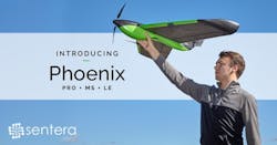
Sentera Introduces Enhanced Phoenix Fixed-Wing Drone With New Low Pricing
Sentera introduces its enhanced, affordable Phoenix fixed-wing drone product line, with variants to support the precision agriculture, mapping, and public safety industries. By pairing cutting-edge technologies with manufacturing efficiencies, Sentera's Phoenix is a cost-effective solution that is easy to fly, accepts a variety of payloads, and covers more acres in less time than competitive options. Complete solution with payload starting at $10,990, the light-weight, highly durable Phoenix is the best valued fixed-wing drone on the market today.
"Our customers depend on us to provide user-friendly drone solutions to collect the data they need at a price that makes sense," remarked Todd Colten, chief aerospace engineer for Sentera. "The Phoenix is a complete professional solution for the quick collection of highly accurate and detailed data – from crop health, to volumetric measurements, to search and rescue operations."
Sensor Compatibility: The Phoenix offers users the highest sensor and mission versatility available, accepting multiple swappable sensors, including the Sentera Double 4K Sensor, providing true RGB and normalized difference vegetation index (NDVI) data, in a single flight. The Sentera Quad Sensor, a multispectral imager with red edge capabilities is also popular in agriculture applications. And, the Sentera Thermal sensor which quickly builds high-resolution true temperature maps.
Speed: With a cruise speed of 35 mph and up to a 59-minute endurance, the Phoenix is capable of covering broad areas that other drones of the same size cannot. In an hour, the Phoenix can collect data from over 700 acres, this is nearly two times more efficient than competitive offerings. Faster data capture means users spend less time in the field and more time focusing on data analysis, determining solutions, and taking action.
Incomparable Precision: While the Phoenix quickly captures data with remarkably little effort, ground sampling distance is under 1.5 inches per pixel at 400 feet. Phoenix sensor payloads are specifically designed for drone applications and automatically geotag all images with millisecond precision, no geotag post processing required. This means more accurate and faster data analysis.
Complete Data Solution: The Phoenix solution offerings include the aircraft, ground datalink and software, application-specific sensor, batteries, chargers, hard-sided case, and software AgVault and OnTop web, mobile, and desktop software allows for real time reading of imagery and the ability to get data off the field for further analysis and discussion.
The product will be featured at AUVSI 2017 in the Dynamic UAV Solutions booth #2940 and is available through Sentera's extensive reseller network.
Watch a 50-second video.
To learn more, visit Sentera's website.
About Sentera
With over 220 years of combined experience with sensors, software, and drone system development, Sentera is a leading supplier of complete data solutions to the agriculture industry, making it easy for users to bring in-field data off the farm for further analysis. In a single growing season, Sentera's equipment gathered hundreds of terabytes of data from 8,000 flights. The company achieved a milestone of collecting more than 25,000,000 acres of images. For more information, visit www.sentera.com.