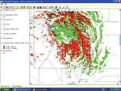
Because many industries depend on reliable radio telecommunications, SoftWright is releasing a new generation of rf coverage presentation tools. The centerpiece of TAP (Terrain Analysis Package) 5.0 is the mapping software called HD (High-definition) Mapper. This state-of-the art GIS mapping software is easier to use than previous versions. Maps are generated with layers, which can be turned on or off. TAP 5.0 retains familiar rf design tools that are easily used. Coverage studies now become one of the many layers that can be plotted on the maps. Users have extensive control over each layer, including color, line widths, fill patterns, symbols and values plotted. Shapefiles can be plotted as graphics showing things such as roads, streets, civil divisions and detailed demographics that are geographically related.