Police Department Saves Time and Money by Increasing Field Data Collection Efficiency
California Penal Code 290 mandates that every sex offender residing in the state must register as such with the police department of the city or county in which they are living. This registration must be renewed every year or when the offender moves to a new address. To make sure all Redlands registered offenders comply with Penal Code 290, Redlands Police Department (RPD) makes an annual surprise house check to verify offenders' residency and observance of the terms of their parole.
In the past, the Redlands 290 sweep began by printing out copies of each registrant's data and contact information. RPD would divide the copies up among teams of officers, who would then complete field interviews to verify compliance. Officers would use pen and paper in the field to update each offender's information and cross the names off the list as they finished the checks. Once they were back at the station, they updated information and manually entered it into spreadsheets.
Challenge
The old method of planning and managing the Redlands 290 sweep was both labor-intensive and time-consuming. For RPD to visit all 125 of the city's resident sex offenders, it would typically take staff weeks to plan and days to fully execute all the home checks. The manual data entry process caused delays and impeded data sharing. Up-to-date information wasn't available until after officers in the field had completed their interviews and the data was entered into the records management system.
Solution
RPD recognized that this process was antiquated and wanted to find a way to modernize workflows. To do this, staff needed to streamline the planning and execution of the operation, enable real-time situational awareness, and accelerate information sharing after the operation was completed. RPD decided to use digital reporting for increased efficiency in the field and live monitoring in the command center. The department realized it could use its existing geographic information system (GIS) to more effectively plan, collect data, and share it.
By leveraging its existing Esri technology investment, RPD was able to digitally map the locations of all the offenders. This data could then be shared with officers in the field via the Survey123 for ArcGIS mobile application. This app was configured for ease of use in data collection. They were then able to configure Operations Dashboard for ArcGIS in the command center to monitor the operation's progress and the officers' locations in real time.
After staff had mapped out each residence, they were able to create zones based on geography that were then assigned to each RPD team. Using these zones increased the efficiency of the teams, as they focused on offender locations based on proximity, reducing unnecessary travel between visits.
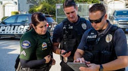
With minimal training, the officer in charge was able to get the task force of 24 officers up and running within minutes using the Survey123 app. The officers then used the app to collect data during each visit with offenders, update their information, and take a photo to include in the database.
As data was collected in the field, the maps in the command center were updated in real time. The dashboard allowed the police chief and command staff to monitor each team's location and track completed interviews as they were updated in the field. This information supported real-time decision-making as the operation progressed.
Results
With the quick and easy configuration of Survey123, the sweep required significantly less time than the labor-intensive pen-and-paper method formerly used. Records were updated in real time, so when changes were made, all records across the system were updated instantly. This streamlined the workflows and maximized operational efficiency.
With geocoding and analysis done ahead of time, each of the teams had its route planned out for maximum efficiency and to minimize redundancy. Mapping out each of the sex offenders' residences and grouping them into zones in ArcGIS Online helped RPD save time and mileage.
The success of this operation and the immediate returns on investment that RPD saw has led the department to plan to geoenable other police operations in the future. With the assistance of maps and apps, RPD hopes to improve crime reduction strategies and support other police initiatives as the department continues to find new and innovative ways to use technology to make Redlands safer.