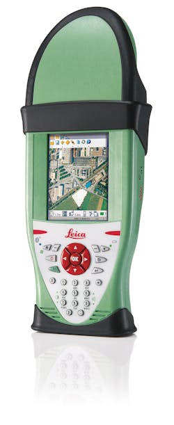
With the introduction of the new Leica Zeno GIS series, it has never been so easy to manage and maintain assets, inspect infrastructure, respond to emergencies, ensure public safety, explore natural resources and conduct as-built and incident mapping with ease. Leica Geosystems' leading measurement technology is now brought to the GIS market. Rugged GNSS/GIS handhelds with productive field software the Leica Zeno 10 provides color graphic display in portrait format and a numeric keypad. Alternatively users have the choice to purchase the larger Leica Zeno 15 with a full QWERTY keyboard and a display in landscape format. Both GNSS/GIS devices support:
- First fully rugged GNSS/GIS handheld working in the most demanding environments
- Dual-constellation (GPS/GLONASS) tracking
- Zeno Field software based on an OEM version of the popular ESRI ArcPad™ 8 software enhanced with GNSS functionality
- An integrated digital camera linking photos to feature locations.
Dual-constellation tracking guarantees higher productivity with more satellites available - in particular in urban canyons and where tree canopy blocks the number of visible GPS satellites. The new Leica Zeno Field software is an OEM version of ESRI ArcPad 8 and provides - in addition - a full range of functions to easily control the integrated GNSS receiver and to manage the asset capture collection process such as GNSS raw data logging, easy handling of GNSS real-time configurations, feature accuracy management, and an automated workflow between the field and office.
