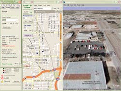
Locarta Technologies Inc., manufacturer of the Locarta Vehicle Tracking System, releases Dashboard 4.1 software. The Locarta Dashboard is the interface between the Locarta 2020, the in-vehicle unit, and the Microsoft MapPoint map display. The new version of the Dashboard adds some ease-of-use features, such an interface to Google Earth. This mapping product from Google together with the Locarta Dashboard allows users to view their vehicles on aerial photography and/or satellite imagery. Users can tilt and rotate the view to see 3D terrain and buildings, save and share searches and even add annotations. All the features of Google Earth are available to the user.
