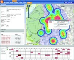
To be on the cutting edge of crime prevention, law enforcement agencies need geospatial data-mining tools that can automatically pull information out of incident databases and provide the means for detecting and stopping spikes in crime before they escalate further. HunchLab is a web-based software solution developed by Azavea that can not only provide conventional crime mapping features, but also apply advanced spatial statistics to find geographic patterns in crime data, notify law enforcement personnel with customized alerts using a geography-based subscription service, and assist them with visualizing those patterns and turning them into useful intelligence.
Pictured: HunchLab's ability to display incident data as a heat map in conjunction with a Time-of-Day/Day-of-Week chart.
