Intrado
11808 Miracle Hills Dr.
Omaha, NE 68154
Omaha, NE 68154
800-841-9000
More Info on Intrado

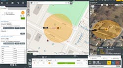
Faster, Safer Incident Response Mapping
Spatial Command & Control provides a shared, precise mapping solution with authoritative GIS data, third-party resources and powerful search tools, combining all the information needed to locate callers and dispatch services quickly, accurately and safely. Using modern Esri technology within a highly configurable display, Spatial Command & Control can also deliver heightened situational awareness across multiple jurisdictions.
- Locate caller and incident locations
- See available responding unit locations
- Find the quickest route
- Get route and unit recommendations
- Estimate arrival times
- Receive traffic updates
And more…all in real-time!
