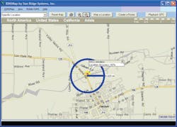
The streets have just gotten safer and emergency response times quicker with the second phase of Enhanced 911 (E911), and Sun Ridge Systems has created the software to support it. E911 Phase II allows emergency dispatchers to locate precisely where 911 cellular phone calls are coming from. Sun Ridge Systems advanced RIMS technology immediately captures the information from an E911 system and plots the transmitted geographical coordinates on a map to pinpoint the location of the call. A circle is drawn on the map, with the center indicating the caller1s location and the radius representing the level of uncertainty. For a quicker response time, RIMS Mobile Mapping plots the same information for officers and emergency response teams in the field.
Request More Information
Request More Information
