NYPD Releases New Interactive Crime Map
The public now has access to more comprehensive crime data thanks to a new interactive map created by the NYPD.
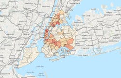
The new map shows the specific location and date of crimes down to the nearest intersection and provides felony crime information for the previous calendar year, current year and by month within the current year.
The NYPD was mandated to create the database after the City Council voted to make the information public earlier this year.
Previously, the only crime data posted online were weekly reports broken down by precinct and patrol borough, which have been available since 2003.
“With unprecedented population levels, New York City is safer than ever, with homicides on pace this year to fall below recent historic lows,” Police Commissioner Ray Kelly said in a statement. “This administration has relied on data to drive its crime fighting, and this map helps enhance New Yorkers’ and researchers’ understanding of where felony and violent crime persists.”
Republished with permission of The New York Post