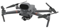
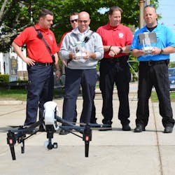
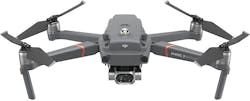
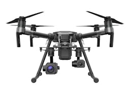
The use of drones in law enforcement is not new, but the ways in which they are used has greatly evolved. Drone deployments have grown from specific incident use to general use on multiple types of scenes. Drones are used for crime scenes and accident scenes in order to get a better overview of an outdoor scene, in pursuits and “attempt to locate” situations to maintain eyes on the subject’s location as well as the roadway situation, or search and rescue operations and tactical surveillance. Other deployments include active shooter situations or hostage or negotiator situations when the drone is equipped with speakers. Recently, with the COVID-19 outbreak, some departments in the U.K. and in the U.S. have deployed drones to “patrol” particular areas of cities to enforce social distancing.
There are many companies that will provide law enforcement with the right training for their drones. Jim O’Keefe, retired police sergeant, explains that DARTdrones offers training for law enforcement officers so that they may acquire FAA licenses and how to develop and implement standard operating procedures for various missions such as search and rescue situations. DARTdrones has several other courses including a hazmat course and a crime scene documentation program. O’Keefe says public safety agencies can benefit from an SUAS (small unmanned aerial system) unit. The ones that are the most common are used for search and rescue, accident reconstruction, or to survey or document crime scenes.
“Officer safety is increased by allowing certain types of operations from a safe distance,” says Kerry Garrison, Vice President of Multicopter Warehouse. “Several of the products can be outfitted with spotlights to enable officers to see into cars and buildings at night and investigate areas that are potentially dangerous.” Garrison also notes that some of the drones may be equipped with a loudspeaker so that law enforcement may address an individual or crowd from a safe distance to issue commands in hectic situations.
Thermal drones provide a great way to detect a subject or any other type of threat that has a heat signature without compromising the investigation or risking officer safety. The majority of thermal imaging drones can go out as far as 4 miles and fly up to approximately 50 miles per hour with a flight time of around 30 minutes. Additional attachments such as other cameras and video cameras may be added to thermal drones. The FLIR Duo Pro R camera has infrared capabilities and can withstand a temperature range of -40 to 275 degrees Fahrenheit. The DJI Zenmuse XT, can provide real-time video footage for surveillance, crime scenes, indoor or outdoor threats, and any other situation where video footage may prove helpful.
Software and VR
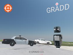
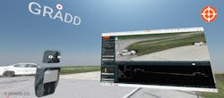
For those departments using drones for accident scenes or crime scenes in particular, Global Robot and Drone Deployment (GRADD) has a new software that immerses the user into the scene itself. GRADD VR (virtual reality) software is a platform for 3D visualization. Using a drone to get an overview of a scene, the software can stitch together hundreds of photos in a manner of minutes and bring an interactive spin to the incident. Instead of going back to photos of a scene, departments can “revisit” where the event took place and essentially process the crime scene all over again, virtually. “Using drones to capture aerial images of an accident provides valuable data that can be used to create high resolution and very accurate 2D and 3D models of the accident for inspection, analysis, visualization and measurement,” says Reza Karamooz, CEO of GRADD.
“Documenting a scene using drone aerial images coupled with ground control point measurements takes a fraction of time when compared to the current methods of documenting an accident scene,” adds Karamooz. GRADD’s software provides solutions and trainings for gathering images from drones. He explains that this is followed by using Reality Capture photogrammetry software to create accurate, high resolution 3D models of accident scenes for inspection, measurement, and 3D visualization. The software allows several investigator to be virtually immersed in a scene at the same time. Karamooz says by using GRADD’s technology accident investigators have the ability to virtually visit the accident scene to analyze, measure and reconstruct critical details about the accident.
Drones enhance officer safety and situational awareness too by adding eyes to situations that are intense such as a pursuit as well as giving an overview of the area of any situation.” Drones provide many uses for law enforcement agencies, from providing birds-eye view of accident and crime scenes to assisting in search and rescue operations, chasing suspects, and managing traffic during rush hours or crowded events,” says Karamooz. If right for your agency’s mission, implementing a drone into everyday policing may allow more “eyes” and add a level of safety without adding more manpower on the streets.

Hilary Rodela
Hilary Rodela is currently a Surveillance Officer, a former Private Investigator, a former Crime Scene Investigator, and Evidence Technician. She worked for the Ruidoso (NM) Police Department as well as the Lubbock (TX) Police Department. She has written for several public safety publications and has extensive law enforcement and forensic training and is pursuing forensic expertise in various disciplines. Hilary is a freelance public safety writer and curriculum developer for the National Investigative Training Academy.
