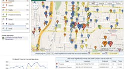
Paraben's Point 2 Point is a GPS point analysis tool that converts the GPS points of tower locations from detailed call records, as well as from other GPS data point sources, and displays them in Google Earth. Investigators also can export data into .kml format (Google Earth format) or PDF format for reporting purposes. Whether the officer has acquired data from GPS devices using Paraben's Device Seizure, or obtained GPS data from other sources, Point 2 Point can help make sense of the data by displaying exact coordinates in Google Earth.
Request More Information
Request More Information
Related Content
Related Content


