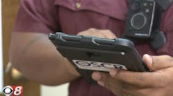
Laser Technology, Inc. released QuickMap 3D® (QM3D) version 7.X, the very first field data collection software available on an Android platform. Crash and crime scene investigators can embrace the simplicity of QM3D currently running on the Windows Mobile devices plus cable-free data transfer, improved workflow on a larger display and built-in help assistance as you map.
The progression of QM3D field data collection software evolved from initially running on a Hewlett Packard HP 48 calculator, to a Palm Pilot and then to Windows Mobile devices, all of which are still in use today. Now available on Android devices, QM3D offers endless new features that will make jobs of crash and crime scene investigator’s much easier. The software’s intuitive workflow makes it simple to collect, store and identify critical evidence as fast as you can point and shoot an LTI laser. To continue with that philosophy, a built-in help tool has been added to include answers to the most commonly asked investigator questions. The updated software also recognizes and connects to LTI lasers automatically and saves data in .txt, .csv, .dxf, .raw and .png formats.
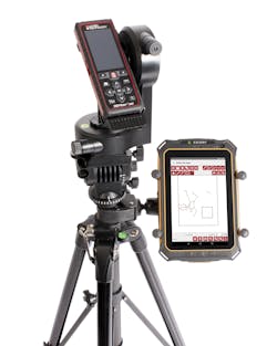
Combined with the CT7, a ruggedized Android tablet by Cedar Tree Technologies (a Juniper Systems company), QuickMap 3D users can map with a TruSpeed Sxb, TruPulse 200X and the TruPoint 300, a brand new mapping laser from LTI that will be available for sale in February, 2016. The TruPoint 300 offers millimeter accuracy and uses a red-dot pointer and camera for targeting. It’s designed to easily measure evidence indoors and within tight spaces. The TruPoint 300 integrates the range and tilt sensor with LTI’s exclusive MapStar Angle Technology for complete 3D measurement capabilities all from the one device.
“LTI has been developing crash mapping lasers for years; however, indoor mapping is a newer market for us. We are excited about the TruPoint 300 laser because it addresses the need for high accuracy, close proximity measurements required to map a crime scene indoors,” says Eric Miller, Laser Technology’s President.
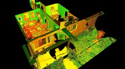
To complete the mapping package, LTI is now offering IMS Map360 by Leica Geosystems. IMS Map360 is a desktop software solution that lets users import, process, analyze, visualize and create court ready deliverables. This program contains built-in tools for seamlessly importing QuickMap 3D native files and .CSV reports. The IMS Map360 addition makes the LTI mapping system a complete field-to-court solution for the crash and crime scene investigator market.


